18th - 29th July 2003
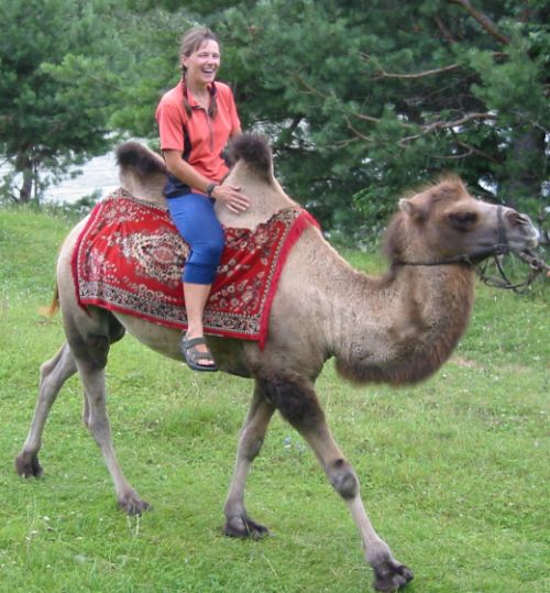
The Chusky Tract was built in the 1930s, at least partly by Gulag labour. It runs into the heart of the Altai Mountains, but is a good road, asphalt covered and well graded. The first 100km from Gorno Altaisk were still busy with lots of tourist traffic, many people camped beside the road and stalls selling tourist nick-naks and food. By tourism has its benefits, the cafes were welcome and we saw our first camel:
Being a tourist camel you could have a ride for 50 roubles, Ju couldn't resist!
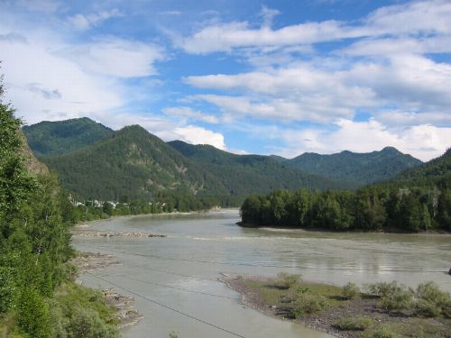
Here the valley is wide and flat and the river is sedate. Lots of people do easy rafting trips down it. We even met some English people who had been working as English teachers in Omsk.
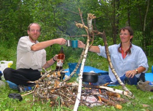
That night was the 19th of July, we celebrated the safe completion of our first year on the road with a bottle of beer and two litres of creamy fresh milk:
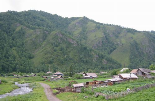
About 50km further on the Chusky Tract road leaves the main river and follows a tributary, most of the traffic is tourists and rafters and they all follow the main river by the road to the rafting centre of Chemal. The Chusky Tract was blessedly quiet from there on. This is the village of Meota where we bought food and were given potatoes, onions and milk by local people. Throughout Siberia we found that the shops do not usually sell fresh food, but that local people were often happy to.
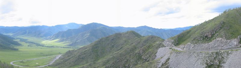
This is looking back down the first and biggest pass on the Tract, the Seminsky Pass, 1800m.The top of the pass was not very exciting, there is a sport hotel with cross country skiers practising on roller-skis and a cafe-van selling shashlik (meat grilled on skewers) and tea. Not even a sign with the height of the pass for a "pass photo".
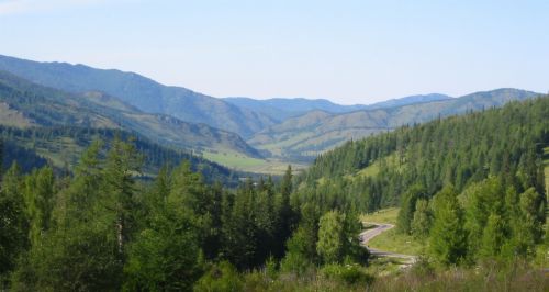
The next pass was not as high but it was steeper and came as more of a surprise (our map did not mark the height of any passes). This is the Chuke-Taman Pass:
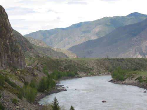
Once over this pass we rejoined the main river. The road was now running through a gorge, and the mountains were getting higher. The dot in the river in the photo below is a party of rafters. The trip from here to Chemal takes six days, slightly slower than cycling!
A bit further on we came to a place where our guidebook said there were petroglyphs on a crag near the road. We searched for over an hour without finding them, but the views were nice. Spot the bicycles:
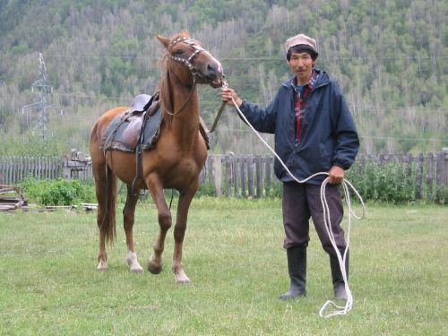
In the village of Iodro we bought milk and potatoes from this man. He was very friendly and chatted to us while his wife and daughter dug up the potatoes. His name is Arthur and he was the first Altai person we had a conversation with. The Altai people are in a minority in Altai, most people are Russians or Kazaks. That evening we made chips!
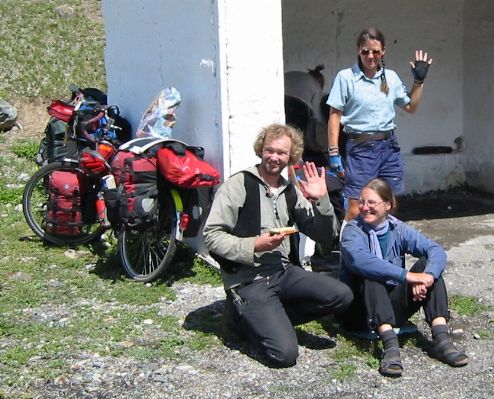
All down the Chusky Tract we saw many wonderful climbing crags, often near the road. This one even had a cafe at its base. Where are the climbers?? The guys on the right are some Dutch and German hikers we met. They had guitars with them so Ju whipped out her flute and we played some tunes together.
 |
 |
After leaving the hikers we passed the military base in Aktash and then climbed part way up a small pass. A thunderstorm arrived and was soon pelting us with cold rain while thunder rolled around the cliffs. We were very glad to reach a picnic place with a covered pagoda and piled into shelter as quickly as possible. There was a party of Russians in the pagoda, but they made us welcome and shared their vodka with us. It transpired that they were military people and when we said we wanted to cross the mountains from Kosh Agach to Tuva they asked if we had the necessary permission. We produced the piece of paper we'd been given in Gorno Altaisk and only then learnt that it was not a permit at all, but a receipt for registering our visas!
They said "Don't worry, we will help you" and said they would take us back to Aktash where we could get the proper permission. They then offered us more vodka, homemade what's worse, but it seemed rude to refuse when they'd offered to help us. Pretty soon we were both inebriated, and then they told us that we needed to go to Kyzyl in Tuva for our permission and left...
Luckily there was a place to camp not far away so we put the tent up and went to sleep. In the morning we rolled back down the pass to Aktash and rather to my surprise were cheerfully given a slip of paper to exchange for a permit in Kosh Agach. So they did help us in the end, but we could have done without the hangover!
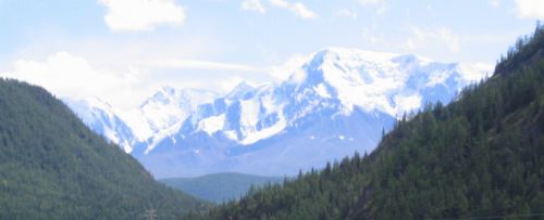
From the top of that pass (10km beyond Aktash) we saw the real mountains for the first time. This is looking towards Kazakstan.
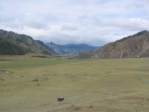
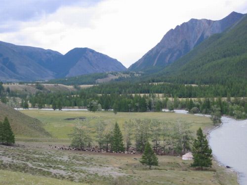
Then the valley began to open out again as we approached the Chusky Steppe. We saw our first ger or yurt (Mongolian nomadic dwelling in the bottom right of the photo) and the trees began to disappear.
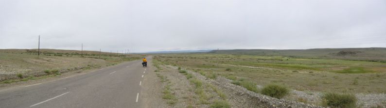
A couple of days later we reached the Steppe, we could still see mountains in the distance but so far away they appeared to be floating above the plain. The Steppe was almost flat and thinly vegetated, populated by the occasional village and herds of goats, horses and further south camels. The day we reached it there was a howling gale blowing from behind us and it was cold (in the morning it had been sleeting - our altitude was about 1700m). Truly we seemed to have come to the end of the earth!
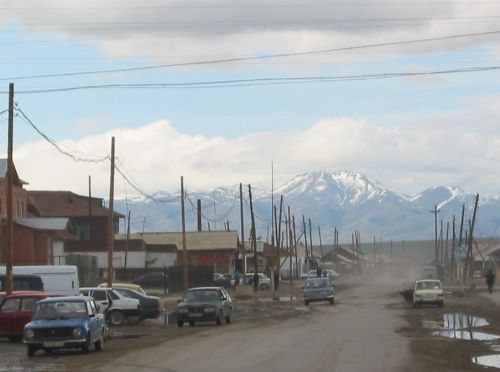
And at the end of the earth we arrived at the town of Kosh Agach. Here we bought a mountain of food to sustain us in our attempt to cross the mountains to Tuva.